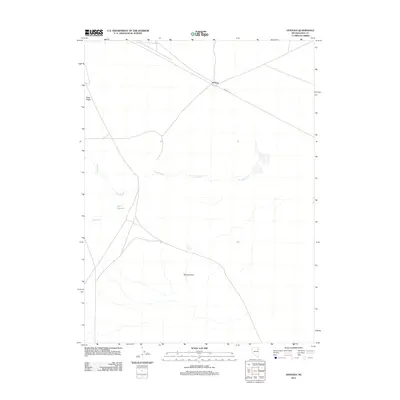
2012 Map of Ventosa
USGS Topo · Published 2012About this map
Ventosa sits at a junction of high-desert infrastructure in eastern Nevada, where the RR Maint Rd tracks the path of essential transit routes. This 2012 survey illustrates the sparse water management systems required in this arid landscape, characterized by the winding path of The Slough and the presence of the Bapt Reservoir. The terrain is defined by prominent topographical markers such as Black Ridge to the northwest and Spruce Point to the south. Small water sources like Point Spring and Steele Cr are critical landmarks in this open country, suggesting a history of land use tied to grazing or transit through the Great Basin. The map captures the quiet intersection of modern maintenance roads and older geographic features that have long dictated movement through Elko County.
Find a feature on this map
8 named features on this map. Tap any name to fly to it.
Don’t see what you’re looking for? This feature index may not catch every label — zoom into the map to look around manually.
Map Details
Editions of this 2012 Ventosa Map
This is the sole edition of this map. No revisions or reprints were ever made.
Other maps of this area

1953 · Spruce Mountain
USGS Topo · 1:62,500

1953 · Spruce Mountain 4
USGS Topo · 1:62,500

1955 · Elko
USGS Topo · 1:250,000

1958 · Elko
USGS Topo · 1:250,000

1962 · Elko
USGS Topo · 1:250,000

1965 · Elko
USGS Topo · 1:250,000

1968 · Independence Valley SW
USGS Topo · 1:24,000

1968 · Snow Water Lake
USGS Topo · 1:24,000

1968 · Ventosa
USGS Topo · 1:24,000
1968 · Snow Water Lake NE
USGS Topo · 1:24,000