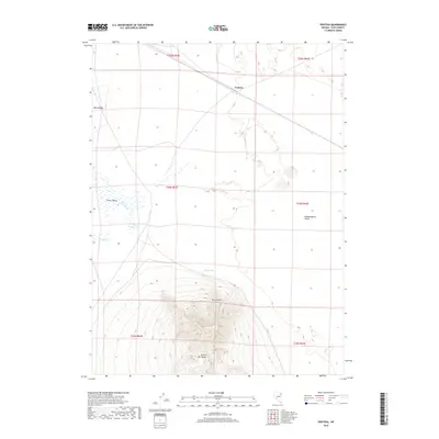
2018 Map of Ventosa
USGS Topo · Published 2018About this map
Ventosa sits at the northern edge of this high desert terrain, where the wide expanses of Clover Valley and Independence Valley meet. The landscape is defined by its water management and drainage patterns, specifically the long, winding course of The Slough and the presence of Bapt Reservoir. To the west, the elevation rises sharply toward Black Ridge, while the southern portion of the sheet is dominated by the dramatic topography of Spruce Mtn Ridge and Spruce Point. These geographic features illustrate the isolation and environmental constraints of Elko County, where seasonal water sources like Point Spring and Steele Cr are critical markers on an otherwise arid canvas. The map provides a clear view of the rural infrastructure and natural boundaries that have long shaped ranching and movement through this part of the Great Basin.
Find a feature on this map
16 named features on this map. Tap any name to fly to it.
Don’t see what you’re looking for? This feature index may not catch every label — zoom into the map to look around manually.
Map Details
Editions of this 2018 Ventosa Map
This is the sole edition of this map. No revisions or reprints were ever made.
Other maps of this area

1953 · Spruce Mountain
USGS Topo · 1:62,500

1953 · Spruce Mountain 4
USGS Topo · 1:62,500

1955 · Elko
USGS Topo · 1:250,000

1958 · Elko
USGS Topo · 1:250,000

1962 · Elko
USGS Topo · 1:250,000

1965 · Elko
USGS Topo · 1:250,000

1968 · Independence Valley SW
USGS Topo · 1:24,000

1968 · Snow Water Lake
USGS Topo · 1:24,000

1968 · Ventosa
USGS Topo · 1:24,000
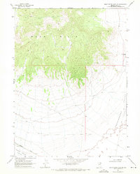
1968 · Snow Water Lake NE
USGS Topo · 1:24,000