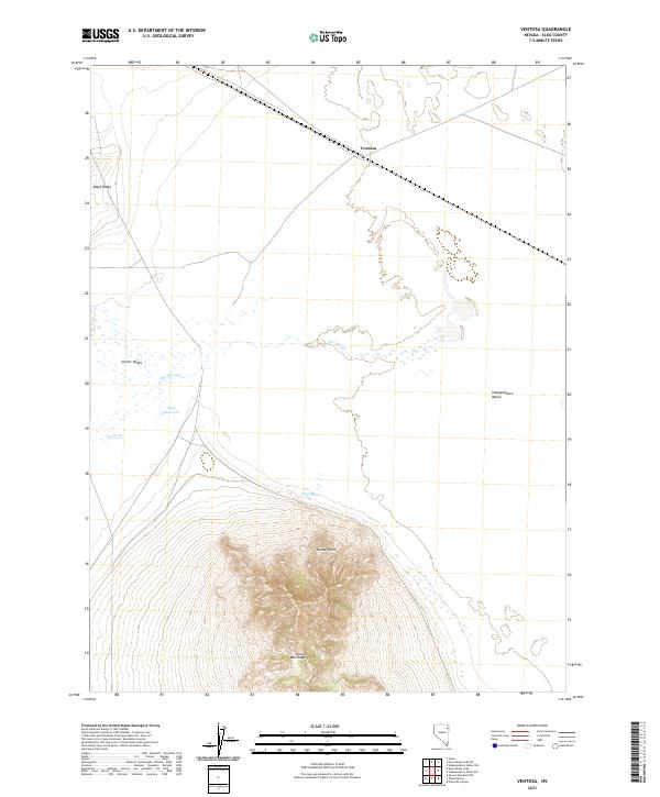
2021 Map of Ventosa
USGS Topo · Published 2021About this map
Ventosa stands as a primary focal point in this high-desert landscape of Elko County, where the transition between Clover Valley and Independence Valley is defined by complex drainage and high elevations. The southern portion of the map is dominated by the steep ascent of Spruce Mtn Ridge, culminating at Spruce Point, a significant topographical landmark that overlooks the surrounding basins. This area illustrates the classic Great Basin hydrology, where seasonal water sources like Steele Cr and Point Spring feed into terminal features such as The Slough. The presence of the Bapt Reservoir suggests the importance of water management for ranching or local industry in this arid corridor. A major railroad line cuts through the northern section near Black Ridge, indicating the historical and modern importance of this route for transcontinental freight movement through Nevada's interior.
Find a feature on this map
16 named features on this map. Tap any name to fly to it.
Don’t see what you’re looking for? This feature index may not catch every label — zoom into the map to look around manually.
Map Details
Editions of this 2021 Ventosa Map
This is the sole edition of this map. No revisions or reprints were ever made.
Other maps of this area

1953 · Spruce Mountain
USGS Topo · 1:62,500

1953 · Spruce Mountain 4
USGS Topo · 1:62,500

1955 · Elko
USGS Topo · 1:250,000

1958 · Elko
USGS Topo · 1:250,000

1962 · Elko
USGS Topo · 1:250,000

1965 · Elko
USGS Topo · 1:250,000

1968 · Independence Valley SW
USGS Topo · 1:24,000

1968 · Snow Water Lake
USGS Topo · 1:24,000

1968 · Ventosa
USGS Topo · 1:24,000
1968 · Snow Water Lake NE
USGS Topo · 1:24,000