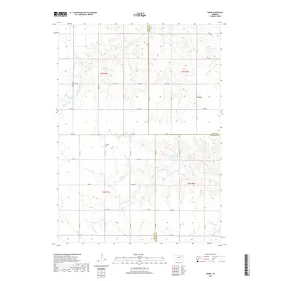
2017 Map of Venus
USGS Topo · Published 2017About this map
Venus marks a quiet crossing in the rural landscape of northeast Nebraska, situated at the boundary where Holt and Knox counties meet. The surrounding terrain is defined by the branching tributaries of Verdigre Creek, including the Middle Br Verdigre Cr and S Br Verdigre Cr. This agricultural region is punctuated by numerous private water management features, such as Waterman Reservoir, Boelter Reservoir, and Cronk Reservoir, reflecting the importance of water storage in this section of the Great Plains. For those tracing family ties to the area, the Lambert Cem stands as a significant genealogical landmark near the headwaters of the south branch. The map provides a detailed view of the sectional road grid, including Co Hwy 108 and Co Oil Rd, which connect these dispersed farmsteads and rural landmarks.
Find a feature on this map
39 named features on this map. Tap any name to fly to it.
Don’t see what you’re looking for? This feature index may not catch every label — zoom into the map to look around manually.
Map Details
Editions of this 2017 Venus Map
This is the sole edition of this map. No revisions or reprints were ever made.
Other maps of this area

1954 · Walnut
USGS Topo · 1:24,000

1954 · Dorsey SW
USGS Topo · 1:24,000

1954 · Star
USGS Topo · 1:24,000

1955 · O'Neill
USGS Topo · 1:250,000

1958 · Page
USGS Topo · 1:24,000

1959 · O'Neill
USGS Topo · 1:250,000

1963 · Ewing SW
USGS Topo · 1:24,000

1963 · Venus
USGS Topo · 1:24,000

1963 · Orchard
USGS Topo · 1:24,000

1963 · Ewing
USGS Topo · 1:24,000