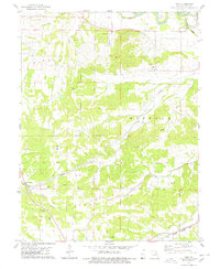
1978 Map of Vera
USGS Topo · Published 1978About this map
The Salt River and its complex network of tributaries, including Sugar Creek and Grassy Creek, define the topography of this corner of Pike County in the late 1970s. This survey highlights the intersection of transportation and small-scale settlement, with the Illinois Central Gulf railroad passing through Vera in the south, while the Burlington Northern line serves Reading along the river in the north. The landscape is dotted with family-named burial grounds like McElwee Cem, Arthur Cem, and Euell Cem, providing significant touchpoints for local genealogists.
Find a feature on this map
32 named features on this map. Tap any name to fly to it.
Don’t see what you’re looking for? This feature index may not catch every label — zoom into the map to look around manually.
Map Details
Editions of this 1978 Vera Map
This is the sole edition of this map. No revisions or reprints were ever made.
Other maps of this area

1890 · Louisiana
USGS Topo · 1:125,000

1931 · Barry
USGS Topo · 1:62,500

1932 · Hannibal
USGS Topo · 1:62,500

1936 · Hannibal
USGS Topo · 1:48,000

1936 · Barry
USGS Topo · 1:48,000

1937 · Bowling Green
USGS Topo · 1:62,500

1940 · Bowling Green
USGS Topo · 1:62,500

1943 · Vandalia
USGS Topo · 1:62,500

1944 · Barry
USGS Topo · 1:62,500

1945 · Hannibal
USGS Topo · 1:62,500