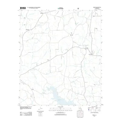
2012 Map of Verda
USGS Topo · Published 2012About this map
Nantachie Lake dominates the southern landscape of this Grant Parish region, where numerous bayous and creeks feed into the sprawling basin. The settlement pattern is defined by small, dispersed communities linked by a dense network of parish roads, including Wheeling, Hargis, and Wetzlar. In the eastern section, the proximity of Verda and New Verda suggests a shift in the local center over time, possibly influenced by road development or local industry. For genealogists, the map is particularly useful for locating family sites near Mars Hill Cem, Six Bits Cem, and Dartigo Cem. The terrain is deeply etched by watercourses such as Nantachie Cr, Dartigo Cr, and Fouchmiah Cr, which dictate the winding paths of rural routes like Harrisonburg RD.
Find a feature on this map
87 named features on this map. Tap any name to fly to it.
Don’t see what you’re looking for? This feature index may not catch every label — zoom into the map to look around manually.
Map Details
Editions of this 2012 Verda Map
This is the sole edition of this map. No revisions or reprints were ever made.
Other maps of this area

1932 · Colfax SW
USGS Topo · 1:31,680

1932 · Colfax NW
USGS Topo · 1:31,680

1935 · Verda
USGS Topo · 1:31,680

1936 · Colfax
USGS Topo · 1:62,500

1937 · Aloha
USGS Topo · 1:31,680

1937 · Montgomery
USGS Topo · 1:62,500

1937 · Cloutierville
USGS Topo · 1:31,680

1942 · Montgomery
USGS Topo · 1:62,500

1945 · Montgomery
USGS Topo · 1:62,500

1949 · Calvin SE
USGS Topo · 1:31,680