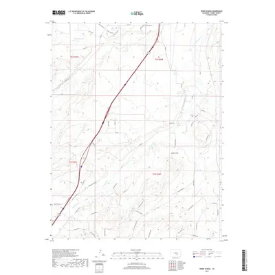
2019 Map of Verde School
USGS Topo · Published 2019About this map
The Saint Charles River and its varied tributaries define this section of Pueblo County, where high-desert drainage patterns meet early 21st-century rural development. Agricultural history is evident in water management features like the Saint Charles Flood Ditch and the Lamb and Smith Ditch, which redirect water through a landscape of arroyos and creeks. For genealogists and local historians, the presence of the Verde School and the nearby Verde Cem provide essential anchor points for tracing the community's legacy in this region. The terrain is marked by distinctive elevations such as Maggies Knob, while the intricate network of modern roads like Greenhorn Creek Dr and Horse Creek Rd shows how newer residential parcels have layered over the traditional cattle and farming tracts. This 2019 survey documents a landscape of transition where traditional ranching landmarks stand alongside contemporary rural living.
Find a feature on this map
55 named features on this map. Tap any name to fly to it.
Don’t see what you’re looking for? This feature index may not catch every label — zoom into the map to look around manually.
Map Details
Editions of this 2019 Verde School Map
This is the sole edition of this map. No revisions or reprints were ever made.
Other maps of this area

1891 · Walsenburg
USGS Topo · 1:125,000

1891 · Pueblo
USGS Topo · 1:125,000

1894 · Walsenburg
USGS Topo · 1:125,000

1894 · Pueblo
USGS Topo · 1:125,000

1896 · Pueblo
USGS Topo · 1:125,000

1897 · Pueblo
USGS Topo · 1:125,000

1897 · Walsenburg
USGS Topo · 1:125,000

1900 · Walsenburg
USGS Topo · 1:125,000

1954 · Trinidad
USGS Topo · 1:250,000

1954 · Pueblo
USGS Topo · 1:250,000