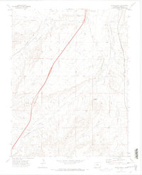
1970 Map of Verde School
USGS Topo · Published 1973About this map
The high plains of Colorado south of Pueblo are defined by the convergence of several major watercourses and a landscape shaped by agricultural irrigation. The St Charles River and its tributary Stinking Arroyo cut through the northern portion of the quadrangle, while Greenhorn Creek and Muddy Creek meet to the south. This era shows a community structured around early twentieth-century local landmarks, including the Verde Sch, the Verde Cem, and the Abbey.
Find a feature on this map
20 named features on this map. Tap any name to fly to it.
Don’t see what you’re looking for? This feature index may not catch every label — zoom into the map to look around manually.
Map Details
Editions of this 1970 Verde School Map
This is the sole edition of this map. No revisions or reprints were ever made.
Other maps of this area

1891 · Walsenburg
USGS Topo · 1:125,000

1891 · Pueblo
USGS Topo · 1:125,000

1894 · Walsenburg
USGS Topo · 1:125,000

1894 · Pueblo
USGS Topo · 1:125,000

1896 · Pueblo
USGS Topo · 1:125,000

1897 · Pueblo
USGS Topo · 1:125,000

1897 · Walsenburg
USGS Topo · 1:125,000

1900 · Walsenburg
USGS Topo · 1:125,000

1954 · Trinidad
USGS Topo · 1:250,000

1954 · Pueblo
USGS Topo · 1:250,000