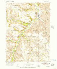
1954 Map of Verdigre
USGS Topo · Published 1956About this map
Verdigre stands at the confluence of several creek branches in this mid-century survey, serving as a hub for the surrounding townships of Bohemia, Sparta, and Jefferson. The town’s layout is closely tied to the Chicago and North Western railroad line, which runs parallel to the water through the eastern half of the quadrangle. Outside the village center, the landscape is defined by a dense network of country schools, including Oak Valley Sch and Pleasant Hill Sch, which point to a well-distributed agricultural population. Local heritage is further anchored by St Wenceslaus Cem and Riverside Cem, reflecting the Czech and central European roots of the settlers who established these Knox County communities. The intricate drainage of the North Branch Verdigre Creek and Middle Branch Verdigre Creek shapes the local topography, influencing the placement of early farmsteads and transport routes.
Find a feature on this map
16 named features on this map. Tap any name to fly to it.
Don’t see what you’re looking for? This feature index may not catch every label — zoom into the map to look around manually.
Map Details
Editions of this 1954 Verdigre Map
2 editions found
Other maps of this area

1950 · Verdigre NE
USGS Topo · 1:24,000

1950 · Pishelville
USGS Topo · 1:24,000

1954 · Walnut
USGS Topo · 1:24,000

1954 · Verdigre
USGS Topo · 1:24,000

1955 · Sioux City
USGS Topo · 1:250,000

1955 · O'Neill
USGS Topo · 1:250,000

1958 · Sioux City
USGS Topo · 1:250,000

1959 · O'Neill
USGS Topo · 1:250,000

1959 · Sioux City
USGS Topo · 1:250,000

1963 · Orchard NE
USGS Topo · 1:24,000