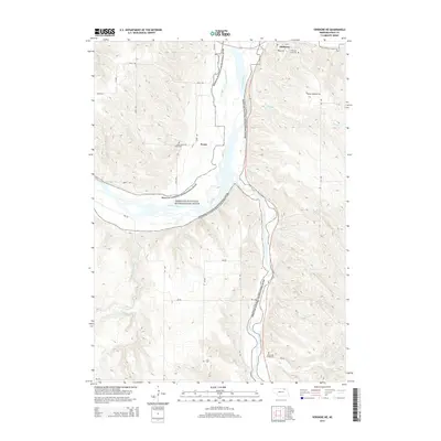
2014 Map of Verdigre NE
USGS Topo · Published 2014About this map
The Niobrara River corridor dominates this Knox County landscape, where the braided river system and the Missouri National Recreational River converge. This 2014 survey captures the distinct water management and drainage patterns of the region, including the Mormon Canal and numerous tributaries such as Verdigre Cr and Bingham Cr. The town of Niobrara sits at the northern edge, near the confluence of these major waterways, while the settlement of Ponca and the Pisel Reservoir are situated further south among the upland ridges.
Find a feature on this map
21 named features on this map. Tap any name to fly to it.
Don’t see what you’re looking for? This feature index may not catch every label — zoom into the map to look around manually.
Map Details
Editions of this 2014 Verdigre NE Map
This is the sole edition of this map. No revisions or reprints were ever made.
Other maps of this area

1950 · Niobrara
USGS Topo · 1:24,000

1950 · Verdel
USGS Topo · 1:24,000

1950 · Verdigre NE
USGS Topo · 1:24,000

1950 · Pishelville
USGS Topo · 1:24,000

1954 · Walnut
USGS Topo · 1:24,000

1954 · Verdigre
USGS Topo · 1:24,000

1955 · Sioux City
USGS Topo · 1:250,000

1955 · O'Neill
USGS Topo · 1:250,000

1958 · Sioux City
USGS Topo · 1:250,000

1959 · O'Neill
USGS Topo · 1:250,000