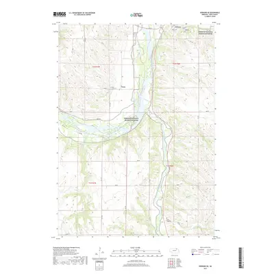
2017 Map of Verdigre NE
USGS Topo · Published 2017About this map
The confluence of the Niobrara River and the Missouri National Recreation River dominates this northern Knox County landscape. Near the settlement of Niobrara, the waterway exhibits a complex braided character, with the Mormon Canal and various secondary channels like Bingham Creek and Burgess Creek threading through the river valley. The topography rises sharply from the river bottom into the dissected uplands, where the Verdigre Creek drainage moves northward toward the Missouri. Genealogists can find several important local burial sites, including L'eau Qui Court Cemetery on the bluffs overlooking the river and the White Mountain Lodge Cemetery further south. The map also records rural landmarks like Saint John's Cemetery near the community of Ponca, and the Paest Reservoir tucked into a eastern drainage, illustrating the region's reliance on managed water sources in this high-plains river environment.
Find a feature on this map
35 named features on this map. Tap any name to fly to it.
Don’t see what you’re looking for? This feature index may not catch every label — zoom into the map to look around manually.
Map Details
Editions of this 2017 Verdigre NE Map
This is the sole edition of this map. No revisions or reprints were ever made.
Other maps of this area

1950 · Niobrara
USGS Topo · 1:24,000

1950 · Verdel
USGS Topo · 1:24,000

1950 · Verdigre NE
USGS Topo · 1:24,000

1950 · Pishelville
USGS Topo · 1:24,000

1954 · Walnut
USGS Topo · 1:24,000

1954 · Verdigre
USGS Topo · 1:24,000

1955 · Sioux City
USGS Topo · 1:250,000

1955 · O'Neill
USGS Topo · 1:250,000

1958 · Sioux City
USGS Topo · 1:250,000

1959 · O'Neill
USGS Topo · 1:250,000