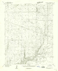
1959 Map of Verdure 1 SE
USGS Topo · Published 1959About this map
Lockerby and Northdale anchor this high plateau landscape along the border of Utah and Colorado, surveyed just before the 1960s. The terrain is defined by deep incisions such as West Fork Canyon and Cottonwood Canyon which cut through the level tableland. Evidence of local settlement and infrastructure is present in the Valley View Cemetery and the inclusion of a Roadside Park along the primary roadway. The hydrological network is dominated by seasonal and perennial drainages including Peterson Wash, Cisco Creek, and Willow Creek. These watercourses, along with numerous small reservoirs scattered across the grid, suggest a landscape carefully managed for ranching or dryland farming. The map effectively captures the transit between the open flats and the dramatic drops into Canyon systems as the land falls away toward the east.
Find a feature on this map
19 named features on this map. Tap any name to fly to it.
Don’t see what you’re looking for? This feature index may not catch every label — zoom into the map to look around manually.
Map Details
Editions of this 1959 Verdure 1 SE Map
This is the sole edition of this map. No revisions or reprints were ever made.
Other maps of this area

1886 · Abajo
USGS Topo · 1:250,000

1892 · Abajo
USGS Topo · 1:250,000

1893 · Abajo
USGS Topo · 1:250,000

1949 · Egnar
USGS Topo · 1:24,000

1950 · Egnar
USGS Topo · 1:24,000

1955 · Verdure 4 NW
USGS Topo · 1:24,000

1955 · Verdure 1 SW
USGS Topo · 1:24,000

1956 · Cortez
USGS Topo · 1:250,000

1957 · Cedar 3 NW
USGS Topo · 1:24,000

1957 · Monument Canyon
USGS Topo · 1:62,500