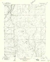
1958 Map of Verdure 2 NE
USGS Topo · Published 1958About this map
Monticello anchors the southern edge of this mid-century topographic survey, where the high plateau begins its descent into the complex drainage systems of San Juan County. The landscape is defined by a reliance on water management, evidenced by the presence of the Keller Reservoir, several unnamed reservoirs, and numerous cattle ponds scattered across the sage-covered flats. To the north, the terrain is cut by Vega Creek and the deep incision of South Canyon, illustrating the erosive power of seasonal runoff in this arid environment. Transportation and infrastructure reflect the area's utility during this era, featuring a dedicated Landing Strip, a network of Jeep Trails, and multiple Gravel Pits. Agricultural markers like the Grain Tank near the reservoir suggest a localized economy focused on dryland ranching and small-scale cultivation before the intensification of modern irrigation.
Find a feature on this map
18 named features on this map. Tap any name to fly to it.
Don’t see what you’re looking for? This feature index may not catch every label — zoom into the map to look around manually.
Map Details
Editions of this 1958 Verdure 2 NE Map
This is the sole edition of this map. No revisions or reprints were ever made.
Other maps of this area

1885 · La Sal
USGS Topo · 1:250,000

1886 · Abajo
USGS Topo · 1:250,000

1892 · Abajo
USGS Topo · 1:250,000

1893 · Abajo
USGS Topo · 1:250,000

1954 · Mt Peale 3 SW
USGS Topo · 1:24,000

1954 · Mt Peale 3 SE
USGS Topo · 1:24,000

1954 · Mt Peale 4 SW
USGS Topo · 1:24,000
1954 · Lisbon Valley
USGS Topo · 1:62,500
1954 · Hatch Rock
USGS Topo · 1:62,500

1955 · Verdure 2 SE
USGS Topo · 1:24,000