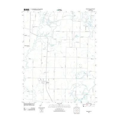
2012 Map of Vergennes
USGS Topo · Published 2012About this map
The village of Vergennes serves as the primary hub of this Southern Illinois landscape, where the flat agricultural terrain is segmented by a dense network of country roads. Much of the local geography is defined by the winding course of Beaucoup Cr and its tributaries, including Walkers Cr and Youngs Cr, which drain the surrounding fields. For genealogists and local historians, the sheet is particularly valuable for its documentation of numerous small family and community burial grounds, such as the Russian Orthodox Cem and Vancil Cem, scattered across the countryside.
Find a feature on this map
79 named features on this map. Tap any name to fly to it.
Don’t see what you’re looking for? This feature index may not catch every label — zoom into the map to look around manually.
Map Details
Editions of this 2012 Vergennes Map
This is the sole edition of this map. No revisions or reprints were ever made.
Other maps of this area

1910 · Herrin
USGS Topo · 1:62,500

1910 · Murphysboro
USGS Topo · 1:62,500

1924 · Pinckneyville
USGS Topo · 1:62,500

1926 · Pinckneyville
USGS Topo · 1:62,500

1926 · Duquoin
USGS Topo · 1:62,500

1936 · Herrin
USGS Topo · 1:62,500

1938 · Murphysboro
USGS Topo · 1:62,500

1949 · Paducah
USGS Topo · 1:250,000

1950 · Paducah
USGS Topo · 1:250,000

1954 · Paducah
USGS Topo · 1:250,000