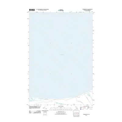
2011 Map of Vermilion SE
USGS Topo · Published 2011About this map
Lake Superior dominates this coastal survey, where the southern shoreline of the Great Lake meets the low-lying wetlands of Whitefish Township. The map depicts a transitional landscape of water and sand, characterized by a series of small, inland water bodies including Weatherhogs Lake, Marsh Lakes, and Little Lake. These features are separated from the open water by narrow coastal strips, reflecting the dynamic geomorphology of Michigan's Upper Peninsula. Development is minimal, limited primarily to a sparse network of unpaved or local access routes such as W Dune Rd, W Wild Cat Rd, and Whitefish-Lake Superior Rd. The layout of these roads suggests a landscape shaped by seasonal access and traditional land use rather than intensive settlement, providing a clear record of the area's rural character in the early 21st century.
Find a feature on this map
8 named features on this map. Tap any name to fly to it.
Don’t see what you’re looking for? This feature index may not catch every label — zoom into the map to look around manually.
Map Details
Editions of this 2011 Vermilion SE Map
This is the sole edition of this map. No revisions or reprints were ever made.
Other maps of this area

1951 · Vermilion SE
USGS Topo · 1:24,000

1951 · Shelldrake
USGS Topo · 1:24,000

1951 · Vermilion
USGS Topo · 1:24,000

1951 · Sheephead Lake
USGS Topo · 1:24,000

1951 · Whitefish Point
USGS Topo · 1:24,000

1951 · Shelldrake
USGS Topo · 1:62,500

1954 · Sault Sainte Marie
USGS Topo · 1:250,000

1956 · Sault Sainte Marie
USGS Topo · 1:250,000

1957 · Sault Sainte Marie
USGS Topo · 1:250,000

1958 · Sault Sainte Marie
USGS Topo · 1:250,000