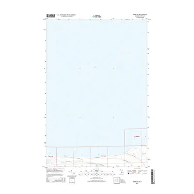
2014 Map of Vermilion SE
USGS Topo · Published 2014About this map
Lake Superior dominates the northern expanse of this coastline in Chippewa County, where the shoreline meets a complex of wetlands and small inland water bodies. The terrain south of the beach is characterized by a series of access routes through the woods, including W Dune Rd and W Wildcat Rd. A cluster of smaller lakes, most notably Weatherhogs Lake, Little Lake, and the Marsh Lakes, are situated just inland from the Great Lake, suggesting a low-lying, sandy environment shaped by glacial and lacustrine processes. These features provide a clear view of the isolated coastal landscape within Whitefish Township during the early 21st century. The map is largely defined by its natural hydrology, with local roads like N Moose Rd and W Oak Ridge RD providing the primary framework for navigating this quiet stretch of the Upper Peninsula.
Find a feature on this map
12 named features on this map. Tap any name to fly to it.
Don’t see what you’re looking for? This feature index may not catch every label — zoom into the map to look around manually.
Map Details
Editions of this 2014 Vermilion SE Map
This is the sole edition of this map. No revisions or reprints were ever made.
Other maps of this area

1951 · Vermilion SE
USGS Topo · 1:24,000

1951 · Shelldrake
USGS Topo · 1:24,000

1951 · Vermilion
USGS Topo · 1:24,000

1951 · Sheephead Lake
USGS Topo · 1:24,000

1951 · Whitefish Point
USGS Topo · 1:24,000

1951 · Shelldrake
USGS Topo · 1:62,500

1954 · Sault Sainte Marie
USGS Topo · 1:250,000

1956 · Sault Sainte Marie
USGS Topo · 1:250,000

1957 · Sault Sainte Marie
USGS Topo · 1:250,000

1958 · Sault Sainte Marie
USGS Topo · 1:250,000