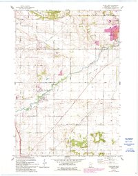
1974 Map of Vermillion
USGS Topo · Published 1993About this map
The Mississippi River and Vermillion River define the hydrography of this Dakota County landscape, where agriculture and infrastructure meet the growing edges of Hastings and Rosemount. The village of Vermillion sits central to the sheet, located south of a Sewage Disposal plant and along the Old Grade Railroad. This 1974 survey, with revisions from 1991, captures the transition of the northern townships of Nininger and Vermillion as residential developments like Imperial Estates Park and Dakota Hills Park expand into the traditional grid of rural section roads.
Find a feature on this map
34 named features on this map. Tap any name to fly to it.
Don’t see what you’re looking for? This feature index may not catch every label — zoom into the map to look around manually.
Map Details
Editions of this 1974 Vermillion Map
2 editions found
Other maps of this area

1896 · St. Paul
USGS Topo · 1:62,500

1946 · Hudson
USGS Topo · 1:62,500

1949 · Hudson
USGS Topo · 1:62,500

1950 · St Paul Park
USGS Topo · 1:24,000

1951 · St Paul Park
USGS Topo · 1:24,000

1951 · Prescott
USGS Topo · 1:24,000

1951 · Inver Grove
USGS Topo · 1:24,000

1951 · St. Paul
USGS Topo · 1:62,500

1953 · Saint Paul
USGS Topo · 1:250,000

1957 · Farmington
USGS Topo · 1:62,500