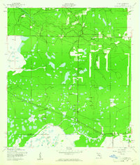
1944 Map of Verna
USGS Topo · Published 1961About this map
Verna and Waterbury anchor this rural landscape in the 1940s, a period when this section of the Florida interior was defined by its intricate drainage networks and early transportation routes. The Manatee River winds through the northern portion of the quadrangle, fed by numerous tributaries including Gilley Creek, Crail Branch, and Boggy Creek. A significant archaeological marker of the area's industrial past is the Old Railroad Grade which cuts diagonally across the southern half of the map, passing through Verna near the Manatee and Sarasota county line. Local social infrastructure is represented by the Bethany School, while hydrological monitoring is noted at the Gaging Station along the river. The terrain is characterized by a high density of small ponds and wet prairies, typical of the flatwoods environment before modern intensive drainage and development altered the local water table.
Find a feature on this map
16 named features on this map. Tap any name to fly to it.
Don’t see what you’re looking for? This feature index may not catch every label — zoom into the map to look around manually.
Map Details
Editions of this 1944 Verna Map
2 editions found
Other maps of this area

1944 · Rye
USGS Topo · 1:31,680

1944 · Verna
USGS Topo · 1:31,680

1944 · Lorraine
USGS Topo · 1:31,680

1944 · Parish
USGS Topo · 1:31,680

1944 · Miakka
USGS Topo · 1:31,680

1947 · Bee Ridge
USGS Topo · 1:24,000

1956 · Myakka City
USGS Topo · 1:24,000

1956 · Myakka City NW
USGS Topo · 1:24,000

1956 · Keentown
USGS Topo · 1:24,000

1956 · Tampa
USGS Topo · 1:250,000