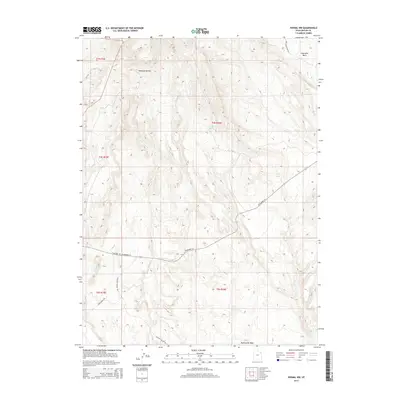
2014 Map of Vernal NW
USGS Topo · Published 2014About this map
Coal Mine Basin and the adjacent northern drainage of Halfway Hollow dominate this portion of the Uintah Basin, revealing a landscape defined by industrial history and seasonal water management. The terrain is crisscrossed by remote access routes like Coal Mine Basin Rd and Dave Murray Rd, which navigate the elevation changes north of W Highway 121. Evidence of historical infrastructure appears at the C C C Tank, likely a remnant of mid-century conservation work in the high desert. Rare water sources such as Cottonwood Spring and the southern drainage of Twelvemile Wash provide the only breaks in the arid topography, serving as critical landmarks for local land use and resource extraction in this corner of the state.
Find a feature on this map
15 named features on this map. Tap any name to fly to it.
Don’t see what you’re looking for? This feature index may not catch every label — zoom into the map to look around manually.
Map Details
Editions of this 2014 Vernal NW Map
This is the sole edition of this map. No revisions or reprints were ever made.
Other maps of this area

1885 · Ashley
USGS Topo · 1:250,000

1906 · Marsh Peak
USGS Topo · 1:125,000

1908 · Marsh Peak
USGS Topo · 1:125,000

1917 · Vernal
USGS Topo · 1:125,000

1954 · Vernal
USGS Topo · 1:250,000

1958 · Vernal
USGS Topo · 1:250,000

1960 · Vernal
USGS Topo · 1:250,000

1964 · Vernal NE
USGS Topo · 1:24,000
1964 · Fort Duchesne
USGS Topo · 1:24,000

1964 · Lapoint
USGS Topo · 1:24,000