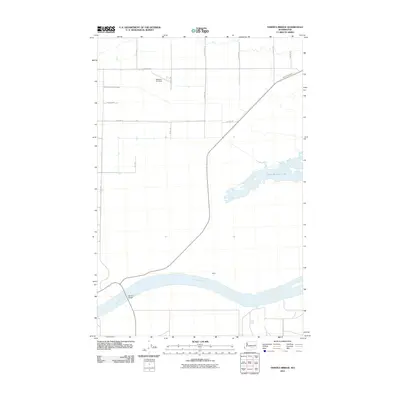
2011 Map of Vernita Bridge
USGS Topo · Published 2011About this map
The Columbia River dominates the southern landscape of this Benton County region, where the Vernita Bridge serves as a critical crossing point for State Route 24. This 2011 survey captures an area defined by irrigation infrastructure and rural development, notably featuring the Saddle Mountain Wasteway and Wahluke Wasteway which channel water across the high desert plains. The small settlement of Haven sits near the riverbanks, reflecting the sparse but deliberate habitation patterns of the Hanford Reach area.
Find a feature on this map
17 named features on this map. Tap any name to fly to it.
Don’t see what you’re looking for? This feature index may not catch every label — zoom into the map to look around manually.
Map Details
Editions of this 2011 Vernita Bridge Map
This is the sole edition of this map. No revisions or reprints were ever made.
Other maps of this area

1911 · Red Rock
USGS Topo · 1:62,500

1912 · Beverly
USGS Topo · 1:62,500

1916 · Coyote Rapids
USGS Topo · 1:62,500

1917 · Priest Rapids
USGS Topo · 1:62,500

1948 · Emerson Nipple
USGS Topo · 1:24,000

1950 · Smyrna
USGS Topo · 1:62,500

1951 · Priest Rapids
USGS Topo · 1:62,500

1951 · Smyrna
USGS Topo · 1:62,500

1951 · Coyote Rapids
USGS Topo · 1:62,500

1953 · Walla Walla
USGS Topo · 1:250,000