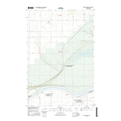
2017 Map of Vernita Bridge
USGS Topo · Published 2017About this map
The Columbia River serves as the focal point for this 2017 survey, marking the boundary between Grant and Benton Counties. This landscape is defined by the complex water management systems of the Saddle Mountain Wasteway and Wahatis Wasteway, which feed into Saddle Mountain Lake. These features reveal the engineered nature of the contemporary high desert, where irrigation runoff is channeled through the arid terrain. The map also highlights significant federally protected lands, including the Saddle Mountain National Wildlife Refuge and portions of the Manhattan Project National Historical Park, underscoring the region's unique intersection of environmental conservation and 20th-century nuclear history. Infrastructure such as the Vernita Bridge and the Mattawa Air Strip provide essential connectivity across the Wahluke Slope, an area characterized by its agricultural potential and vast open spaces.
Find a feature on this map
23 named features on this map. Tap any name to fly to it.
Don’t see what you’re looking for? This feature index may not catch every label — zoom into the map to look around manually.
Map Details
Editions of this 2017 Vernita Bridge Map
This is the sole edition of this map. No revisions or reprints were ever made.
Other maps of this area

1911 · Red Rock
USGS Topo · 1:62,500

1912 · Beverly
USGS Topo · 1:62,500

1916 · Coyote Rapids
USGS Topo · 1:62,500

1917 · Priest Rapids
USGS Topo · 1:62,500

1948 · Emerson Nipple
USGS Topo · 1:24,000

1950 · Smyrna
USGS Topo · 1:62,500

1951 · Priest Rapids
USGS Topo · 1:62,500

1951 · Smyrna
USGS Topo · 1:62,500

1951 · Coyote Rapids
USGS Topo · 1:62,500

1953 · Walla Walla
USGS Topo · 1:250,000