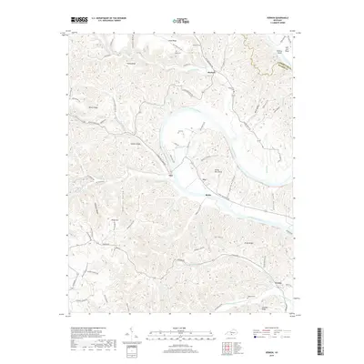
2019 Map of Vernon
USGS Topo · Published 2019About this map
The Cumberland River carves a sweeping path through this portion of Monroe County, defining a landscape of sharp ridges and deep hollows. Small riverfront communities and inland hamlets like Vernon, Meshack, and Otia are connected by a network of winding roads that follow the natural topography, such as Turkey Neck Bend Rd and Meredith Creek Rd. The terrain is characterized by prominent elevations including Cloyd Ridge and Pruitt Ridge, while the river itself features distinctive landmarks like Stallcup Island and Salt Lick Bend. Genealogists and local historians will find value in the scattered family cemeteries, including the Kirkpatrick Cem, Gee Cem, and Stephens Cem, which mark the long-standing settlement of the hollows and ridge-lines that define this Kentucky river country.
Find a feature on this map
90 named features on this map. Tap any name to fly to it.
Don’t see what you’re looking for? This feature index may not catch every label — zoom into the map to look around manually.
Map Details
Editions of this 2019 Vernon Map
This is the sole edition of this map. No revisions or reprints were ever made.
Other maps of this area

1924 · Lillydale
USGS Topo · 1:62,500

1926 · Lillydale
USGS Topo · 1:62,500

1929 · Lillydale
USGS Topo · 1:62,500

1929 · Tompkinsville
USGS Topo · 1:62,500

1953 · Sulphur Lick
USGS Topo · 1:24,000

1953 · Waterview
USGS Topo · 1:24,000

1953 · Dubre
USGS Topo · 1:24,000

1954 · Blacks Ferry
USGS Topo · 1:24,000

1954 · Tompkinsville
USGS Topo · 1:24,000
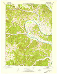
1954 · Vernon
USGS Topo · 1:24,000