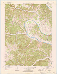
1981 Map of Vernon
USGS Topo · Published 1983About this map
The Cumberland River carves a dramatic path through Monroe County in this mid-century topographic record, defining the serpentine landscape of Turkey Neck Bend and Glasscock Bend. The area's river-based economy and transportation are underscored by the presence of McMillans Ferry, while the dissected uplands are dotted with rural community hubs including Meshack, Center Point, and Vernon. Local genealogy and settlement patterns are clearly visible through a dense network of country schools and churches, such as Antioch Sch, New Walnut Grove Sch, and Locust Hill Ch. The terrain is characterized by steep ridges like Tooley Ridge and Pruitt Ridge, where narrow hollows like Neds Hollow and Capshaw Hollow have dictated the placement of family farmsteads and rural roads. A notable geographic feature, the Natural Tunnel, appears near the northern boundary, illustrating the unique karst-influenced topography of this Kentucky-Tennessee border region.
Find a feature on this map
61 named features on this map. Tap any name to fly to it.
Don’t see what you’re looking for? This feature index may not catch every label — zoom into the map to look around manually.
Map Details
Editions of this 1981 Vernon Map
This is the sole edition of this map. No revisions or reprints were ever made.
Other maps of this area

1924 · Lillydale
USGS Topo · 1:62,500

1926 · Lillydale
USGS Topo · 1:62,500

1929 · Lillydale
USGS Topo · 1:62,500

1929 · Tompkinsville
USGS Topo · 1:62,500

1953 · Sulphur Lick
USGS Topo · 1:24,000

1953 · Waterview
USGS Topo · 1:24,000

1953 · Dubre
USGS Topo · 1:24,000

1954 · Blacks Ferry
USGS Topo · 1:24,000

1954 · Tompkinsville
USGS Topo · 1:24,000
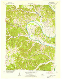
1954 · Vernon
USGS Topo · 1:24,000