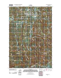
2011 Map of Vernonia
USGS Topo · Published 2011About this map
Vernonia serves as the central hub of this Columbia County landscape, situated at the confluence of the Nehalem River and Rock Creek. The town's layout is defined by its timber-country history, with the Vernonia Post Office and nearby Vernonia Airfield anchoring the community. Beyond the main settlement, the terrain is marked by a network of hills including Corey Hill, O-A Hill, and Hoffman Hill. Smaller outlying localities like Treharne, Braun, and Bacona dot the valleys of Beaver Creek and Pebble Creek, reflecting the dispersed settlement patterns typical of Oregon's coast range foothills. The map reveals a transition from the structured streets of the town center to the winding logging and access roads like Pebble Creek Mnln and Bacona Rd that penetrate the surrounding uplands. Genealogists will find the locations of the Vernonia Cemetery and Pioneer Cemetery useful for tracing local family histories.
Find a feature on this map
72 named features on this map. Tap any name to fly to it.
Don’t see what you’re looking for? This feature index may not catch every label — zoom into the map to look around manually.
Map Details
Editions of this 2011 Vernonia Map
This is the sole edition of this map. No revisions or reprints were ever made.
Other maps of this area

1940 · Vernonia
USGS Topo · 1:62,500

1941 · Keasey
USGS Topo · 1:62,500

1941 · Timber
USGS Topo · 1:62,500

1941 · Gales Creek
USGS Topo · 1:62,500

1943 · Vernonia
USGS Topo · 1:62,500

1943 · Keasey
USGS Topo · 1:62,500

1948 · Vancouver
USGS Topo · 1:250,000

1950 · Vancouver
USGS Topo · 1:250,000

1950 · Vancouver
USGS Topo · 1:250,000

1955 · Timber
USGS Topo · 1:62,500