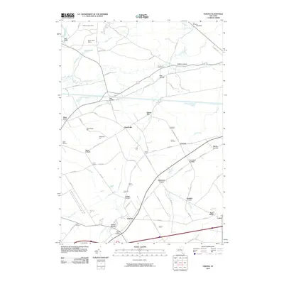
2010 Map of Verona
USGS Topo · Published 2010About this map
Verona and its surrounding hamlets are defined by a complex network of waterways and historic crossroad settlements in this northern New York landscape. The historic corridor of Wood Creek and the nearby New London area highlight the region's long-standing connection to inland navigation, while the Rome Sand Plains to the north mark a distinct ecological pocket. Significant family-named nodes such as Agnes Corners, Stooks Corners, and Cagwin Corners suggest a history of decentralized rural development and family landholdings common to Oneida County. Local genealogy is well-preserved through several burial sites including Link Cemetery, Greenway Cemetery, and Joslyn Cemetery. The map also captures the local transition from agriculture to conservation and recreation, evidenced by Sugarbush Farm and the Fort Rickey Game Farm, all set against a backdrop of extensive wetlands like the Swamp along Brandy Brook.
Find a feature on this map
88 named features on this map. Tap any name to fly to it.
Don’t see what you’re looking for? This feature index may not catch every label — zoom into the map to look around manually.
Map Details
Editions of this 2010 Verona Map
This is the sole edition of this map. No revisions or reprints were ever made.
Other maps of this area

1895 · Oriskany
USGS Topo · 1:62,500

1895 · Oneida
USGS Topo · 1:62,500

1898 · Oneida
USGS Topo · 1:62,500

1898 · Oriskany
USGS Topo · 1:62,500

1902 · Oneida
USGS Topo · 1:62,500

1904 · Boonville
USGS Topo · 1:62,500

1905 · Taberg
USGS Topo · 1:62,500

1939 · Oneida
USGS Topo · 1:62,500

1943 · Camden East
USGS Topo · 1:31,680

1943 · Lee Center
USGS Topo · 1:31,680