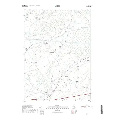
2019 Map of Verona
USGS Topo · Published 2019About this map
The Erie Canal remains a defining artery of this central New York landscape, paralleled by the N Country National Scenic Trail and the Heelpath Rd as it cuts through the village of New London. This corridor, historically vital to regional trade, is surrounded by numerous small hamlets and agricultural junctions including Seifert Corners, Churchville, and Verona Mills. To the north, the Rome Sand Plains present a distinct geological character, while the southern reaches are marked by the broad Verona Swamp and the drainage of Brandy Brook. Genealogists will find several burial grounds across the township, such as Greenway Cem, Joslyn Cem, and Lewis Cem, which anchor the local history of family-named settlements like Cagwin Corners and Blackmans Corners. The presence of Becks Grove Airport and Curtis Airport highlights the area's continued utility as a transportation hub north of Verona.
Find a feature on this map
104 named features on this map. Tap any name to fly to it.
Don’t see what you’re looking for? This feature index may not catch every label — zoom into the map to look around manually.
Map Details
Editions of this 2019 Verona Map
This is the sole edition of this map. No revisions or reprints were ever made.
Other maps of this area

1895 · Oriskany
USGS Topo · 1:62,500

1895 · Oneida
USGS Topo · 1:62,500

1898 · Oneida
USGS Topo · 1:62,500

1898 · Oriskany
USGS Topo · 1:62,500

1902 · Oneida
USGS Topo · 1:62,500

1904 · Boonville
USGS Topo · 1:62,500

1905 · Taberg
USGS Topo · 1:62,500

1939 · Oneida
USGS Topo · 1:62,500

1943 · Camden East
USGS Topo · 1:31,680

1943 · Lee Center
USGS Topo · 1:31,680