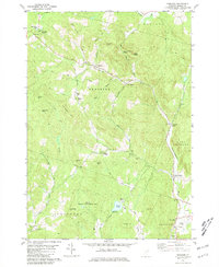
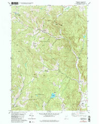
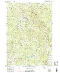
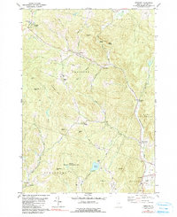
1981 Map of Vershire
USGS Topo · Published 1981About this map
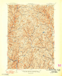
The Ompompanoosuc River and its numerous tributaries, including Back Brook and Falls Brook, dictate the settlement patterns of this Orange County landscape. Small village clusters and family-named landmarks are scattered throughout the hills, from Vershire Heights in the northwest to Post Mills in the southeast. The interior is characterized by steep elevations such as Colton Hill and Hawkins Mtn, where a network of gravel and unimproved roads like Darling Hill Rd and Old City Road link isolated farmsteads and rural schoolhouses like the Mountain Sch.
Find a feature on this map
49 named features on this map. Tap any name to fly to it.
Don’t see what you’re looking for? This feature index may not catch every label — zoom into the map to look around manually.
Map Details
Editions of this 1981 Vershire Map
4 editions found
Other maps of this area

1896 · Strafford
USGS Topo · 1:62,500

1931 · Mt. Cube
USGS Topo · 1:62,500

1931 · Woodsville
USGS Topo · 1:48,000

1933 · Mt. Cube
USGS Topo · 1:62,500

1935 · Woodsville
USGS Topo · 1:62,500

1941 · Woodsville
USGS Topo · 1:62,500
1944 · Strafford
USGS Topo · 1:62,500

1947 · Corinth
USGS Topo · 1:62,500

1948 · East Barre
USGS Topo · 1:62,500

1950 · Glens Falls
USGS Topo · 1:250,000