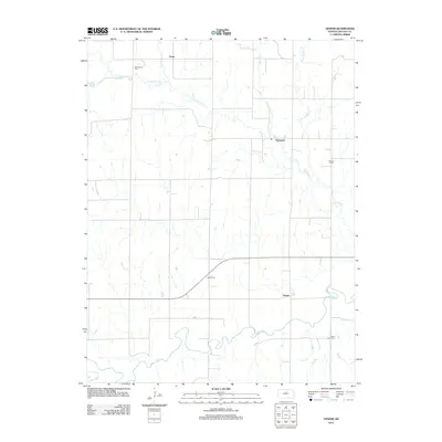
2012 Map of Vesper
USGS Topo · Published 2012About this map
Saline River meanders across the southern portion of this Lincoln County landscape, defining the local drainage and topography in a region marked by agricultural grid lines and seasonal watercourses. The settlement of Vesper sits just north of the river, while the community of Denmark is located further north along Spillman Cr. The map reveals a high density of small rural burial grounds, including Pottersburg Cem, Mission Cem, Vesper Cem, and Saint John Cem, which serve as vital markers for genealogical research in this part of Kansas. A network of local roads such as N ST connects these dispersed points of interest across the Grant township area, while numerous creeks like Trail Cr, Bacon Cr, and Little Timber Cr carve through the plains, illustrating the natural irrigation patterns of the central Kansas prairie.
Find a feature on this map
13 named features on this map. Tap any name to fly to it.
Don’t see what you’re looking for? This feature index may not catch every label — zoom into the map to look around manually.
Map Details
Editions of this 2012 Vesper Map
This is the sole edition of this map. No revisions or reprints were ever made.
Other maps of this area

1894 · Ellsworth
USGS Topo · 1:125,000

1894 · Beloit
USGS Topo · 1:125,000

1955 · Great Bend
USGS Topo · 1:250,000

1955 · Beloit
USGS Topo · 1:250,000

1957 · Great Bend
USGS Topo · 1:250,000

1958 · Great Bend
USGS Topo · 1:250,000

1959 · Beloit
USGS Topo · 1:250,000

1962 · Vesper
USGS Topo · 1:24,000

1962 · Lincoln
USGS Topo · 1:24,000

1963 · Sylvan Grove
USGS Topo · 1:24,000