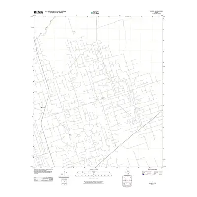
2010 Map of Vesrue
USGS Topo · Published 2010About this map
Magwalt and Vesrue sit within a landscape defined by industrial and ranching infrastructure in this corner of Winkler County. The map reveals an intricate network of local roads and tracks, many serving scattered encampments such as Star Camp, Carter Camp, and PerryBass Camp. This settlement pattern suggests an economy deeply tied to resource extraction or large-scale ranch operations common to the Permian Basin region during the early 21st century. Natural hydrology is represented by Monument Draw, while the human adaptation to this arid environment is evident in water-sourcing landmarks like Scott Windmill and Baird Windmill. Primary transit through the area is managed by Fm 874 and Ranch Rd 1218, connecting these remote outposts to the wider West Texas region.
Find a feature on this map
14 named features on this map. Tap any name to fly to it.
Don’t see what you’re looking for? This feature index may not catch every label — zoom into the map to look around manually.
Map Details
Editions of this 2010 Vesrue Map
This is the sole edition of this map. No revisions or reprints were ever made.
Other maps of this area

1954 · Hobbs
USGS Topo · 1:250,000

1954 · Pecos
USGS Topo · 1:250,000

1957 · Pecos
USGS Topo · 1:250,000

1958 · Hobbs
USGS Topo · 1:250,000

1969 · Jal
USGS Topo · 1:24,000

1969 · Jal SE
USGS Topo · 1:24,000

1970 · Wink North
USGS Topo · 1:24,000

1970 · Vesrue
USGS Topo · 1:24,000

1970 · Kermit NW
USGS Topo · 1:24,000

1970 · Kermit
USGS Topo · 1:24,000