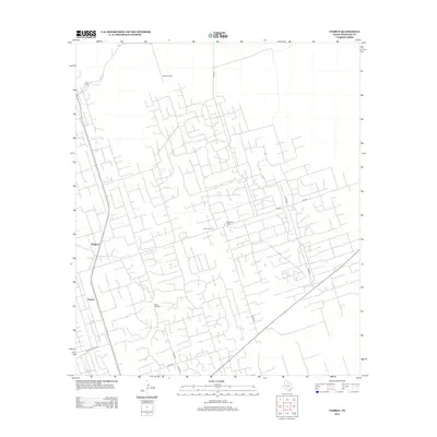
2012 Map of Vesrue
USGS Topo · Published 2012About this map
Vesrue and Magwalt anchor this high-desert landscape in the Permian Basin, where the human footprint is defined by a dense, geometric network of industrial and ranching roads. The area's character is shaped by specialized outposts and resource points such as Star Camp, Carter Camp, and Perry Bass Camp, which suggest the intensive activity of the regional energy industry. Water, the most critical resource in this arid Texas territory, is marked by isolated landmarks like Scott Windmill and Baird Windmill. The infrastructure is remarkably intricate, with numerous unnamed tracks branching off major thoroughfares like Walton Ranch Rd and FM-1218. This complex grid reflects a landscape optimized for utility, where every turn leads to a specific site or wellhead, illustrating the modern evolution of the rural Texas frontier into a highly managed industrial workspace.
Find a feature on this map
15 named features on this map. Tap any name to fly to it.
Don’t see what you’re looking for? This feature index may not catch every label — zoom into the map to look around manually.
Map Details
Editions of this 2012 Vesrue Map
This is the sole edition of this map. No revisions or reprints were ever made.
Other maps of this area

1954 · Hobbs
USGS Topo · 1:250,000

1954 · Pecos
USGS Topo · 1:250,000

1957 · Pecos
USGS Topo · 1:250,000

1958 · Hobbs
USGS Topo · 1:250,000

1969 · Jal
USGS Topo · 1:24,000

1969 · Jal SE
USGS Topo · 1:24,000

1970 · Wink North
USGS Topo · 1:24,000

1970 · Vesrue
USGS Topo · 1:24,000

1970 · Kermit NW
USGS Topo · 1:24,000

1970 · Kermit
USGS Topo · 1:24,000