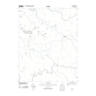
2010 Map of Vest
USGS Topo · Published 2010About this map
Decoy and the surrounding Knott County landscape appear here in 2010, dominated by the intricate drainage systems of Quicksand Creek and its many forks. The topography is defined by a dense network of hollows, including names like Spruce Pine Hollow, Cucumber Hollow, and Splash Dam Hollow, which speak to the area's timber and geography. Small settlements and former community centers such as Grigsby and Baker Camp are situated along the valley floors, connected by winding mountain roads like Buckhorn Rd and Elmrock Decoy Rd. Family history is preserved in localized landmarks including the Whitt Howard Cemetery, Compton Cemetery, and Dobson Cemetery. The map captures the physical reality of these eastern Kentucky ridges and creek beds, where prominent high points like Drill Knob and Potato Knob stand above the narrow, winding hollows that have shaped local settlement for generations.
Find a feature on this map
105 named features on this map. Tap any name to fly to it.
Don’t see what you’re looking for? This feature index may not catch every label — zoom into the map to look around manually.
Map Details
Editions of this 2010 Vest Map
This is the sole edition of this map. No revisions or reprints were ever made.
Other maps of this area

1886 · Prestonsburg
USGS Topo · 1:125,000

1889 · Salyersville
USGS Topo · 1:125,000

1890 · Whitesburg
USGS Topo · 1:125,000

1891 · Hazard
USGS Topo · 1:125,000

1891 · Salyersville
USGS Topo · 1:125,000

1892 · Whitesburg
USGS Topo · 1:125,000

1892 · Prestonsburg
USGS Topo · 1:125,000

1899 · Salyersville
USGS Topo · 1:125,000

1912 · Hindman
USGS Topo · 1:48,000

1914 · Troublesome
USGS Topo · 1:62,500