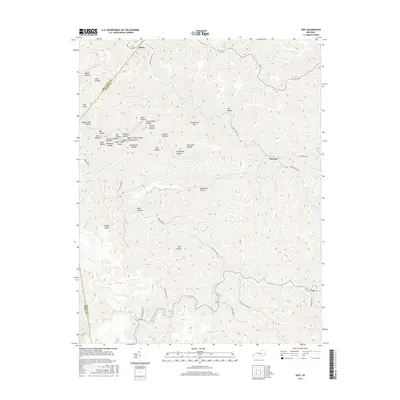
2016 Map of Vest
USGS Topo · Published 2016About this map
Vest and Decoy sit within a highly dissected plateau landscape in eastern Kentucky, where the topography is defined by an intricate network of narrow ridges and named hollows. The settlement pattern follows the drainage, with homes and roads clinging to the valley floors of Little Buckhorn and the Cutoff Branch. The naming conventions of the terrain offer a glimpse into local history and folklore, with evocative labels such as Deadmans Hollow, Suicide Hollow, and Splash Dam Hollow indicating past events or early timber industry practices. Higher elevations are marked by prominent peaks like Potato Knob and Grey Horse Hill, while the county lines of Breathitt, Knott, and Perry converge along the southern and western ridges. Transport in this part of the Cumberland Plateau relies on winding routes like Elmrock Decoy Rd and Hwy 1087, which navigate the tight gaps between the steep hillsides.
Find a feature on this map
43 named features on this map. Tap any name to fly to it.
Don’t see what you’re looking for? This feature index may not catch every label — zoom into the map to look around manually.
Map Details
Editions of this 2016 Vest Map
This is the sole edition of this map. No revisions or reprints were ever made.
Other maps of this area

1886 · Prestonsburg
USGS Topo · 1:125,000

1889 · Salyersville
USGS Topo · 1:125,000

1890 · Whitesburg
USGS Topo · 1:125,000

1891 · Hazard
USGS Topo · 1:125,000

1891 · Salyersville
USGS Topo · 1:125,000

1892 · Whitesburg
USGS Topo · 1:125,000

1892 · Prestonsburg
USGS Topo · 1:125,000

1899 · Salyersville
USGS Topo · 1:125,000

1912 · Hindman
USGS Topo · 1:48,000

1914 · Troublesome
USGS Topo · 1:62,500