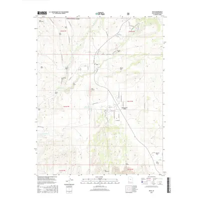
2017 Map of Veyo
USGS Topo · Published 2017About this map
Veyo Volcano dominates the northern landscape of this region, standing just south of the settlement of Veyo. The terrain here is defined by volcanic features and the drainage of the Santa Clara River, which flows through the center of the sheet toward the Red Mountains and Snow Canyon. Agricultural and residential development is concentrated in the southern basins of Dammeron Valley and Diamond Valley, while the northern portion is largely occupied by the Dixie National Forest. Water management is a critical aspect of this arid landscape, evidenced by the Upper Sand Cove Reservoir and Lower Sand Cove Reservoir. The map provides detailed tracking of rural infrastructure, from the Veyo Cem to the winding paths of Veyo Shoal Creek Rd and N Spanish Trail Dr, reflecting the modern expansion of these high-desert communities.
Find a feature on this map
69 named features on this map. Tap any name to fly to it.
Don’t see what you’re looking for? This feature index may not catch every label — zoom into the map to look around manually.
Map Details
Editions of this 2017 Veyo Map
This is the sole edition of this map. No revisions or reprints were ever made.
Other maps of this area

1885 · St. George
USGS Topo · 1:250,000

1891 · St. George
USGS Topo · 1:250,000

1953 · Cedar City
USGS Topo · 1:250,000

1954 · Beaver Dam Mts NE
USGS Topo · 1:24,000

1954 · Gunlock
USGS Topo · 1:24,000

1954 · St. George
USGS Topo · 1:62,500

1956 · St. George NW
USGS Topo · 1:24,000

1956 · St. George NE
USGS Topo · 1:24,000

1958 · Cedar City
USGS Topo · 1:250,000

1962 · Cedar City
USGS Topo · 1:250,000