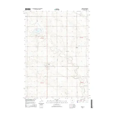
2015 Map of Viborg
USGS Topo · Published 2015About this map
Viborg serves as the primary hub of this eastern South Dakota landscape, where the rectilinear grid of county roads meets a complex network of prairie waterways. The town is situated at the junction of N State St and 291st St, with residential streets reaching toward the surrounding agricultural fields. To the northeast, the smaller settlement of Hooker sits near the drainage of Mears Ditch, reflecting the historical pattern of small-town development along transportation and drainage corridors.
Find a feature on this map
31 named features on this map. Tap any name to fly to it.
Don’t see what you’re looking for? This feature index may not catch every label — zoom into the map to look around manually.
Map Details
Editions of this 2015 Viborg Map
This is the sole edition of this map. No revisions or reprints were ever made.
Other maps of this area

1897 · Canton
USGS Topo · 1:125,000

1898 · Parker
USGS Topo · 1:125,000

1900 · Canton
USGS Topo · 1:125,000

1955 · Sioux Falls
USGS Topo · 1:250,000

1958 · Sioux Falls
USGS Topo · 1:250,000

1964 · Lennox
USGS Topo · 1:24,000
1968 · Beresford NW
USGS Topo · 1:24,000
1968 · Hurley
USGS Topo · 1:24,000

1968 · Parker SW
USGS Topo · 1:24,000
1968 · Wakonda
USGS Topo · 1:24,000