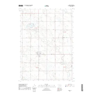
2017 Map of Viborg
USGS Topo · Published 2017About this map
Viborg stands as the central hub of this eastern South Dakota landscape, where the grid of county roads meets the natural curves of Turkey Ridge Cr and the Vermillion River. This 2017 survey by the U.S. Geological Survey reveals a region deeply tied to its agricultural roots and community history, evidenced by the numerous local burial grounds such as Rose Hill Cem, Hattervig Cem, and the Grace Lutheran Cem. The terrain is shaped by significant water features including Swan Lake to the northwest and the engineered path of Mears Ditch in the east. Tracing the rural township lines of t97n r53w and t97n r52w, the map details a persistent settlement pattern, from the small community of Hooker to the residential streets of Viborg like W Lincoln Ave and E Park Ave.
Find a feature on this map
38 named features on this map. Tap any name to fly to it.
Don’t see what you’re looking for? This feature index may not catch every label — zoom into the map to look around manually.
Map Details
Editions of this 2017 Viborg Map
This is the sole edition of this map. No revisions or reprints were ever made.
Other maps of this area

1897 · Canton
USGS Topo · 1:125,000

1898 · Parker
USGS Topo · 1:125,000

1900 · Canton
USGS Topo · 1:125,000

1955 · Sioux Falls
USGS Topo · 1:250,000

1958 · Sioux Falls
USGS Topo · 1:250,000

1964 · Lennox
USGS Topo · 1:24,000
1968 · Beresford NW
USGS Topo · 1:24,000
1968 · Hurley
USGS Topo · 1:24,000

1968 · Parker SW
USGS Topo · 1:24,000
1968 · Wakonda
USGS Topo · 1:24,000