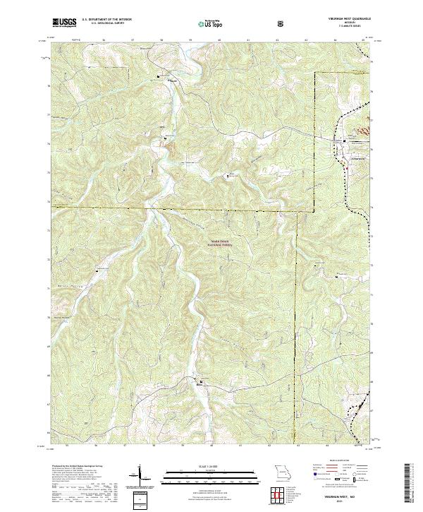
2021 Map of Viburnum West
USGS Topo · Published 2021About this map
Huzzah Creek and its many tributaries, including James Br and W Fork Huzzah Cr, carve through this section of the Mark Twain National Forest along the borders of Dent, Crawford, and Iron counties. The landscape is defined by its deep hollows, such as Beefsteak Hollow and Tinker Hollow, which historically dictated the placement of small Ozark settlements. The community of Viburnum serves as a local hub on the eastern edge, featuring the Viburnum Airport and First Baptist Church.
Find a feature on this map
45 named features on this map. Tap any name to fly to it.
Don’t see what you’re looking for? This feature index may not catch every label — zoom into the map to look around manually.
Map Details
Editions of this 2021 Viburnum West Map
This is the sole edition of this map. No revisions or reprints were ever made.
Other maps of this area

1932 · Steelville
USGS Topo · 1:48,000

1933 · Steelville
USGS Topo · 1:62,500

1937 · Steelville
USGS Topo · 1:62,500

1941 · Stone Hill
USGS Topo · 1:62,500

1943 · Berryman
USGS Topo · 1:62,500

1943 · Boss
USGS Topo · 1:62,500

1945 · Stone Hill
USGS Topo · 1:62,500

1945 · Berryman
USGS Topo · 1:62,500

1946 · Boss
USGS Topo · 1:62,500

1949 · Rolla
USGS Topo · 1:250,000