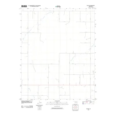
2010 Map of Vici NW
USGS Topo · Published 2010About this map
Northwestern Woodward County is defined by a sparse, rural landscape dominated by a network of sectional roads and the drainage systems of the eastern Oklahoma plains. The topography is shaped by the meandering courses of North Persimmon Creek and South Persimmon Creek, which provide the primary geographical relief across the section lines. This area maintains the classic Great Plains grid system, with roads such as N 2000 Rd and E 0580 Rd providing access to the vast ranchlands and agricultural plots. In the southern portion of the quadrangle, Turkey Creek cuts through the terrain, further marking the natural watersheds of the region. The map reflects a modern period of rural land management where the traditional prairie has been methodically partitioned by infrastructure while remaining largely undeveloped.
Find a feature on this map
18 named features on this map. Tap any name to fly to it.
Don’t see what you’re looking for? This feature index may not catch every label — zoom into the map to look around manually.
Map Details
Editions of this 2010 Vici NW Map
This is the sole edition of this map. No revisions or reprints were ever made.
Other maps of this area

1955 · Woodward
USGS Topo · 1:250,000

1958 · Woodward
USGS Topo · 1:250,000

1969 · Vici NW
USGS Topo · 1:24,000

1969 · Woodward SW
USGS Topo · 1:24,000

1969 · Sharon
USGS Topo · 1:24,000

1969 · Fargo SE
USGS Topo · 1:24,000

1969 · Camargo
USGS Topo · 1:24,000

1969 · Vici
USGS Topo · 1:24,000

1970 · Harmon
USGS Topo · 1:24,000
1970 · Harmon SE
USGS Topo · 1:24,000