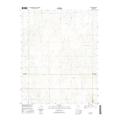
2016 Map of Vici NW
USGS Topo · Published 2016About this map
Woodward, Ellis, and Dewey counties meet at a triple point in this remote corner of the Oklahoma panhandle region. The landscape is defined by the dendritic drainage patterns of N Persimmon Cr, S Persimmon Cr, and Turkey Cr, which carve through the high plains. While the territory lacks formal town sites, it is organized by a precise grid of sectional roads including NS 197 RD and e0610 RD. This 2016 survey captures the area's agricultural character, where the intersection of Woodward Co, Ellis Co, and Dewey Co boundaries serves as the primary landmark in an otherwise open prairie environment.
Find a feature on this map
29 named features on this map. Tap any name to fly to it.
Don’t see what you’re looking for? This feature index may not catch every label — zoom into the map to look around manually.
Map Details
Editions of this 2016 Vici NW Map
This is the sole edition of this map. No revisions or reprints were ever made.
Other maps of this area

1955 · Woodward
USGS Topo · 1:250,000

1958 · Woodward
USGS Topo · 1:250,000

1969 · Vici NW
USGS Topo · 1:24,000

1969 · Woodward SW
USGS Topo · 1:24,000

1969 · Sharon
USGS Topo · 1:24,000

1969 · Fargo SE
USGS Topo · 1:24,000

1969 · Camargo
USGS Topo · 1:24,000

1969 · Vici
USGS Topo · 1:24,000

1970 · Harmon
USGS Topo · 1:24,000
1970 · Harmon SE
USGS Topo · 1:24,000