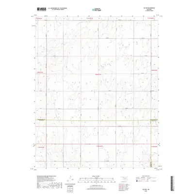
2018 Map of Vici NW
USGS Topo · Published 2018About this map
N Persimmon Cr and S Persimmon Cr define the drainage patterns across this rural stretch of the Oklahoma panhandle region, where the borders of Woodward, Ellis, and Dewey Counties converge. The landscape is structured by a rigid section-line road grid, including routes like N1980 Rd and E0540 Rd, which facilitate movement between the dispersed farmsteads of the High Plains. To the southwest, Turkey Cr winds through the terrain near the junction of Ew 61 and NS 197 Rd. This late-period survey illustrates the enduring nature of the Public Land Survey System, showing how township boundaries like t20n r21w continue to dictate the organization of land and infrastructure in this agricultural territory.
Find a feature on this map
37 named features on this map. Tap any name to fly to it.
Don’t see what you’re looking for? This feature index may not catch every label — zoom into the map to look around manually.
Map Details
Editions of this 2018 Vici NW Map
This is the sole edition of this map. No revisions or reprints were ever made.
Other maps of this area

1955 · Woodward
USGS Topo · 1:250,000

1958 · Woodward
USGS Topo · 1:250,000

1969 · Vici NW
USGS Topo · 1:24,000

1969 · Woodward SW
USGS Topo · 1:24,000

1969 · Sharon
USGS Topo · 1:24,000

1969 · Fargo SE
USGS Topo · 1:24,000

1969 · Camargo
USGS Topo · 1:24,000

1969 · Vici
USGS Topo · 1:24,000

1970 · Harmon
USGS Topo · 1:24,000
1970 · Harmon SE
USGS Topo · 1:24,000