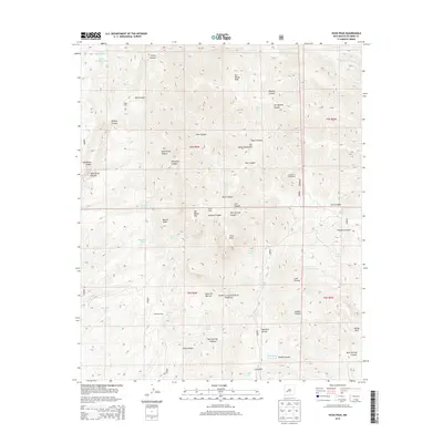
2013 Map of Vicks Peak
USGS Topo · Published 2013About this map
Cibola National Forest encompasses the high-elevation terrain of the San Mateo Mountains, where the landscape is defined by a dense network of canyons and peaks. This 2013 survey documents the topography around Vicks Peak and San Mateo Peak, revealing a landscape marked by scattered high-country outposts. Early 21st-century water management is evident through numerous features like Upper Holdup Tank, Whitetail Tank, and Rock Head Dam Tank, essential for sustaining life in this arid environment. The map details several historic or seasonal habitations, including Cooks Cabin, Myers Cabin, and Shipman Cabin, which suggest the area's ongoing use for forestry or ranching. Recreational access is anchored by Springtime Campground and Luna Park, while the intricate drainages of Rock Springs Canyon, Wild Horse Canyon, and Milo Canyon create a complex geography for those studying the southern reaches of the range.
Find a feature on this map
62 named features on this map. Tap any name to fly to it.
Don’t see what you’re looking for? This feature index may not catch every label — zoom into the map to look around manually.
Map Details
Editions of this 2013 Vicks Peak Map
This is the sole edition of this map. No revisions or reprints were ever made.
Other maps of this area

1954 · Tularosa
USGS Topo · 1:250,000

1958 · Tularosa
USGS Topo · 1:250,000

1961 · Sierra Fijardo
USGS Topo · 1:24,000

1961 · Monticello
USGS Topo · 1:24,000

1964 · Welty Hill
USGS Topo · 1:24,000

1964 · Vicks Peak
USGS Topo · 1:24,000

1964 · San Juan Peak
USGS Topo · 1:24,000

1964 · Blue Mountain
USGS Topo · 1:24,000

1964 · Montoya Butte
USGS Topo · 1:24,000

1964 · Steel Hill
USGS Topo · 1:24,000