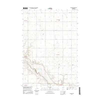
2016 Map of Vicksburg
USGS Topo · Published 2016About this map
The Minnesota River carves a deep valley across this portion of the Renville-Redwood county line, creating a dramatic break in the otherwise flat agricultural grid of Emmet Township. Along the bluffs, the settlement of Vicksburg sits near its namesake Vicksburg Cemetery, overlooking a complex of backwaters and seasonal basins including Beckendorf Lake and Gold Mine Lake. This landscape is defined by its deep roots in family and faith, evidenced by an unusually high density of small cemeteries and family burial grounds that dot the section lines. From the Anson C Fisk Family Plot and Schmitt Family Cemetery to larger community sites like Bethany Lutheran Cemetery, these features provide a detailed record of the families who settled this prairie. The extensive drainage system, including County Ditch Number Thirty-five A and Timms Creek, illustrates the persistent effort to manage the high water table for productive farming.
Find a feature on this map
40 named features on this map. Tap any name to fly to it.
Don’t see what you’re looking for? This feature index may not catch every label — zoom into the map to look around manually.
Map Details
Editions of this 2016 Vicksburg Map
This is the sole edition of this map. No revisions or reprints were ever made.
Other maps of this area

1952 · Redwood Falls
USGS Topo · 1:62,500

1953 · New Ulm
USGS Topo · 1:250,000

1957 · New Ulm
USGS Topo · 1:250,000

1958 · New Ulm
USGS Topo · 1:250,000

1965 · Danube
USGS Topo · 1:24,000

1965 · Belview
USGS Topo · 1:24,000

1965 · Iverson Lake
USGS Topo · 1:24,000

1965 · Sacred Heart
USGS Topo · 1:24,000

1965 · Renville
USGS Topo · 1:24,000

1967 · New Ulm
USGS Topo · 1:250,000