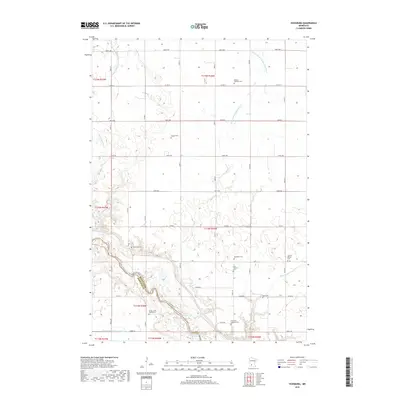
2019 Map of Vicksburg
USGS Topo · Published 2019About this map
The Minnesota River carves a deep valley across the southwestern corner of this township, defining the boundary between Renville Co and Redwood Co. This riparian corridor stands in sharp contrast to the surrounding agricultural uplands, which are systematically drained by an extensive network of engineered waterways, including County Ditch Number Thirtyfive A and Ditch Number Ninetytwo. These ditches redirect water from former wetlands toward the main river channel, enabling the grid of section-line roads like Co Rd 4 that organize the landscape.
Find a feature on this map
40 named features on this map. Tap any name to fly to it.
Don’t see what you’re looking for? This feature index may not catch every label — zoom into the map to look around manually.
Map Details
Editions of this 2019 Vicksburg Map
This is the sole edition of this map. No revisions or reprints were ever made.
Other maps of this area

1952 · Redwood Falls
USGS Topo · 1:62,500

1953 · New Ulm
USGS Topo · 1:250,000

1957 · New Ulm
USGS Topo · 1:250,000

1958 · New Ulm
USGS Topo · 1:250,000

1965 · Danube
USGS Topo · 1:24,000

1965 · Belview
USGS Topo · 1:24,000

1965 · Iverson Lake
USGS Topo · 1:24,000

1965 · Sacred Heart
USGS Topo · 1:24,000

1965 · Renville
USGS Topo · 1:24,000

1967 · New Ulm
USGS Topo · 1:250,000