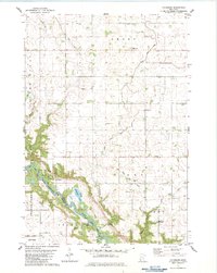
1982 Map of Vicksburg
USGS Topo · Published 1983About this map
The Minnesota River carves a deep, wooded valley through the agricultural plains of Renville County, creating a sharp contrast between the riverside bluffs and the surrounding farmland. This landscape is defined by its extensive drainage network, where numerous engineered waterways like County Ditch No 127 and County Ditch No 45 feed into the river's tributaries. Near the small settlement of Vicksburg, the Old Indian Treaty Boundary cuts diagonally across the terrain, serving as a silent reminder of early territorial negotiations in the region.
Find a feature on this map
40 named features on this map. Tap any name to fly to it.
Don’t see what you’re looking for? This feature index may not catch every label — zoom into the map to look around manually.
Map Details
Editions of this 1982 Vicksburg Map
This is the sole edition of this map. No revisions or reprints were ever made.
Other maps of this area

1952 · Redwood Falls
USGS Topo · 1:62,500

1953 · New Ulm
USGS Topo · 1:250,000

1957 · New Ulm
USGS Topo · 1:250,000

1958 · New Ulm
USGS Topo · 1:250,000

1965 · Danube
USGS Topo · 1:24,000

1965 · Belview
USGS Topo · 1:24,000

1965 · Iverson Lake
USGS Topo · 1:24,000

1965 · Sacred Heart
USGS Topo · 1:24,000

1965 · Renville
USGS Topo · 1:24,000

1967 · New Ulm
USGS Topo · 1:250,000