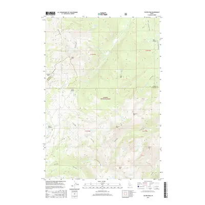
2017 Map of Victor Peak
USGS Topo · Published 2017About this map
The high alpine crests of Bear Pete Ridge dominate this section of the Payette National Forest, where the landscape is defined by deep glacial cirques and high-elevation basins. Dozens of small lakes and seasonal drainages emerge from the high points of Victor Peak and Storm Peak, feeding complex creek systems including Victor Creek and Loon Creek. The map documents a rugged wilderness environment punctuated by specific topographic landmarks such as Diamond Rock and Squaw Point.
Find a feature on this map
51 named features on this map. Tap any name to fly to it.
Don’t see what you’re looking for? This feature index may not catch every label — zoom into the map to look around manually.
Map Details
Editions of this 2017 Victor Peak Map
This is the sole edition of this map. No revisions or reprints were ever made.
Other maps of this area

1938 · Riggins
USGS Topo · 1:96,000

1945 · Riggins
USGS Topo · 1:125,000

1955 · Grangeville
USGS Topo · 1:250,000

1956 · Burgdorf
USGS Topo · 1:62,500

1956 · Elk City
USGS Topo · 1:250,000

1959 · Grangeville
USGS Topo · 1:250,000

1960 · Elk City
USGS Topo · 1:250,000

1963 · Granite Lake
USGS Topo · 1:24,000

1963 · Black Tip
USGS Topo · 1:24,000

1963 · Hershey Point
USGS Topo · 1:24,000