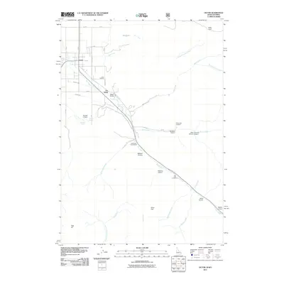
2011 Map of Victor
USGS Topo · Published 2011About this map
The settlement of Victor and the surrounding Teton Valley are defined by a complex network of irrigation and mountainous terrain as they appeared in the early 21st century. Civil engineering is prominent through features like the Kearsley Canal, String Canal, and Kimball Canal, which manage water flow through the valley floor. Small local enclaves such as The String and Sweet Hollow sit near the base of the mountains, while the Victor Cemetery provides a specific point of interest for genealogical research.
Find a feature on this map
47 named features on this map. Tap any name to fly to it.
Don’t see what you’re looking for? This feature index may not catch every label — zoom into the map to look around manually.
Map Details
Editions of this 2011 Victor Map
This is the sole edition of this map. No revisions or reprints were ever made.
Other maps of this area

1899 · Grand Teton
USGS Topo · 1:125,000

1901 · Grand Teton
USGS Topo · 1:125,000

1931 · Jackson
USGS Topo · 1:125,000

1932 · Irwin
USGS Topo · 1:96,000

1935 · Irwin
USGS Topo · 1:125,000

1935 · Jackson
USGS Topo · 1:125,000

1943 · Driggs
USGS Topo · 1:62,500

1946 · Driggs
USGS Topo · 1:62,500

1955 · Driggs
USGS Topo · 1:250,000

1958 · Driggs
USGS Topo · 1:250,000