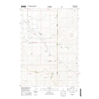
2013 Map of Victor
USGS Topo · Published 2013About this map
The town of Victor sits at the foot of the Snake River Range in this modern topographic study of the Idaho-Wyoming border. The landscape is defined by the complex water management of the Teton Basin, where several irrigation channels including Tonks Canal, Humble Canal, and Spencer Canal diverge from natural watercourses to support the high-altitude valley. Significant local infrastructure is noted, such as the Victor Cem and the Old Jackson Hwy winding eastward toward the mountains. To the east and south, the terrain rises sharply into the Targhee National Forest, characterized by deep cuts like Mikesell Canyon and Nordell Canyon. This survey captures the transition from the settled valley floor to the protected wilderness of the surrounding peaks, including Oliver Peak and Fogg Hill, while documenting recreational sites like Mike Harris Campground and Trail Creek Campground.
Find a feature on this map
68 named features on this map. Tap any name to fly to it.
Don’t see what you’re looking for? This feature index may not catch every label — zoom into the map to look around manually.
Map Details
Editions of this 2013 Victor Map
This is the sole edition of this map. No revisions or reprints were ever made.
Other maps of this area

1899 · Grand Teton
USGS Topo · 1:125,000

1901 · Grand Teton
USGS Topo · 1:125,000

1931 · Jackson
USGS Topo · 1:125,000

1932 · Irwin
USGS Topo · 1:96,000

1935 · Irwin
USGS Topo · 1:125,000

1935 · Jackson
USGS Topo · 1:125,000

1943 · Driggs
USGS Topo · 1:62,500

1946 · Driggs
USGS Topo · 1:62,500

1955 · Driggs
USGS Topo · 1:250,000

1958 · Driggs
USGS Topo · 1:250,000