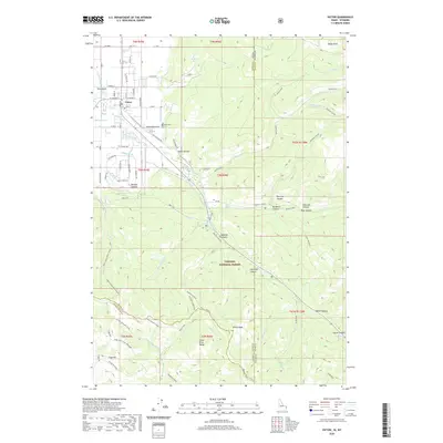
2020 Map of Victor
USGS Topo · Published 2020About this map
Victor serves as the primary hub of the Teton Basin, where the valley floor meets the rising peaks of the Snake River Range. In this 2020 edition, the settlement pattern reveals a detailed irrigation network essential to the region, including the Kimball Canal, Tonks Canal, and Spencer Canal which fan out from the canyon mouths to the agricultural flats. The map documents the interface between private land and the Targhee National Forest, marked by numerous drainage features such as Nordell Canyon and Mikesell Canyon. Local history is anchored by the Victor Cemetery, while the surrounding terrain is defined by prominent landmarks like Oliver Peak and the high ridges of Pole Canyon Ridge. This survey traces the complex geography of the Idaho-Wyoming state line as it cuts through rugged drainages like Stateline Canyon and Moose Creek, illustrating the remote character of the eastern forest boundary.
Find a feature on this map
98 named features on this map. Tap any name to fly to it.
Don’t see what you’re looking for? This feature index may not catch every label — zoom into the map to look around manually.
Map Details
Editions of this 2020 Victor Map
This is the sole edition of this map. No revisions or reprints were ever made.
Other maps of this area

1899 · Grand Teton
USGS Topo · 1:125,000

1901 · Grand Teton
USGS Topo · 1:125,000

1931 · Jackson
USGS Topo · 1:125,000

1932 · Irwin
USGS Topo · 1:96,000

1935 · Irwin
USGS Topo · 1:125,000

1935 · Jackson
USGS Topo · 1:125,000

1943 · Driggs
USGS Topo · 1:62,500

1946 · Driggs
USGS Topo · 1:62,500

1955 · Driggs
USGS Topo · 1:250,000

1958 · Driggs
USGS Topo · 1:250,000