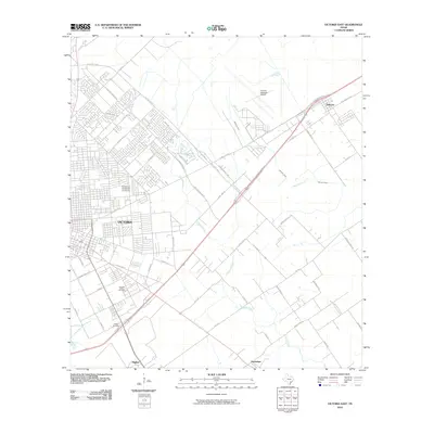
2010 Map of Victoria East
USGS Topo · Published 2010About this map
Victoria expands eastward in this 2010 survey, showing the transition from the city's residential and educational hubs to the coastal prairie ranching land of South Texas. The campus of the University of Houston in Victoria anchors the northwest, while the city's grid gives way to established local routes like Lone Tree Rd and Burroughsville Rd. The landscape is defined by the winding drainages of Placedo Creek and Mercado Creek, which dictate the placement of rural roads and small clusters of settlement. To the northeast, Telferner sits along the major highway corridor, while the southern reaches near Guadalupe and Hughes remain more agricultural. Genealogists and local historians can locate the Pleasant Green Cemetery and Jewett Cemetery, providing essential markers of the area's community heritage amidst the modern infrastructure of the Victoria Regional Airport.
Find a feature on this map
50 named features on this map. Tap any name to fly to it.
Don’t see what you’re looking for? This feature index may not catch every label — zoom into the map to look around manually.
Map Details
Editions of this 2010 Victoria East Map
This is the sole edition of this map. No revisions or reprints were ever made.
Other maps of this area

1951 · Bloomington
USGS Topo · 1:24,000

1951 · Inez NW
USGS Topo · 1:24,000

1951 · Inez
USGS Topo · 1:24,000

1952 · Marcado Creek
USGS Topo · 1:24,000

1952 · Placedo
USGS Topo · 1:24,000

1952 · Victoria East
USGS Topo · 1:24,000

1953 · Beeville
USGS Topo · 1:250,000

1956 · Beeville
USGS Topo · 1:250,000

1960 · Beeville
USGS Topo · 1:250,000

1962 · Raisin
USGS Topo · 1:24,000