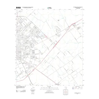
2013 Map of Victoria East
USGS Topo · Published 2013About this map
Victoria Regional Airport dominates the northeast quadrant of this landscape, marking the city's modern expansion toward the prairie. The urban periphery is characterized by a dense residential street grid, including major arteries like Ben Jordan St and the sweeping arc of Ne Zac Lentz Pkwy. Moving away from the concentrated development of Victoria, the land transitions into rural tracts defined by the winding paths of Placedo Creek, Marcado Creek, and Casa Blanca Cr.
Find a feature on this map
161 named features on this map. Tap any name to fly to it.
Don’t see what you’re looking for? This feature index may not catch every label — zoom into the map to look around manually.
Map Details
Editions of this 2013 Victoria East Map
This is the sole edition of this map. No revisions or reprints were ever made.
Other maps of this area

1951 · Bloomington
USGS Topo · 1:24,000

1951 · Inez NW
USGS Topo · 1:24,000

1951 · Inez
USGS Topo · 1:24,000

1952 · Marcado Creek
USGS Topo · 1:24,000

1952 · Placedo
USGS Topo · 1:24,000

1952 · Victoria East
USGS Topo · 1:24,000

1953 · Beeville
USGS Topo · 1:250,000

1956 · Beeville
USGS Topo · 1:250,000

1960 · Beeville
USGS Topo · 1:250,000

1962 · Raisin
USGS Topo · 1:24,000