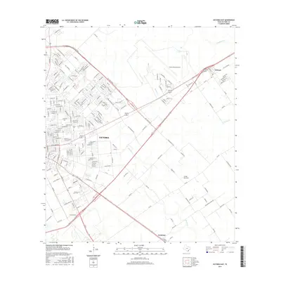
2016 Map of Victoria East
USGS Topo · Published 2016About this map
Victoria serves as the focal point for this eastern quadrangle, where the city's residential and educational growth meets the coastal prairie landscape of South Texas. The campus of Univ of Houston-Victoria and Victoria Coll occupy a significant portion of the urban layout, while Zac Lentz Pkwy loops around the northern edge of the settlement. Beyond the city limits, the terrain is defined by the drainages of Placedo Cr and Arroyo Palo Alto, which wind through a network of rural roads such as Wischaemper School Rd and Burroughsville Rd. To the northeast, the settlement of Telferner sits along the transit corridor near the Victoria Regional Airport. This map provides valuable detail for those researching local family history, noting the locations of Pleasant Green Cem and Jewett Cem at the southern edge of the survey area, near the community of Guadalupe.
Find a feature on this map
167 named features on this map. Tap any name to fly to it.
Don’t see what you’re looking for? This feature index may not catch every label — zoom into the map to look around manually.
Map Details
Editions of this 2016 Victoria East Map
This is the sole edition of this map. No revisions or reprints were ever made.
Other maps of this area

1951 · Bloomington
USGS Topo · 1:24,000

1951 · Inez NW
USGS Topo · 1:24,000

1951 · Inez
USGS Topo · 1:24,000

1952 · Marcado Creek
USGS Topo · 1:24,000

1952 · Placedo
USGS Topo · 1:24,000

1952 · Victoria East
USGS Topo · 1:24,000

1953 · Beeville
USGS Topo · 1:250,000

1956 · Beeville
USGS Topo · 1:250,000

1960 · Beeville
USGS Topo · 1:250,000

1962 · Raisin
USGS Topo · 1:24,000